Purna Ganji
GIS Technician | GIS Analyst | IT Technician | Frontend Developer | Researcher
About
I’m Purna Ganji, detail-oriented GIS professional, IT Support Specialist with a Master's degree in Natural & Applied Sciences(GIS & Data Science), Geospatial Sciences Certificate (in progress),Data Science Certificate (in progress), 1+ year of experience in spatial data management, digitizing, and mapping in academic and professional settings. Proficient in ArcGIS Pro and GIS software, with strong analytical skills and the ability to handle detailed spatial data editing tasks. Committed to accuracy and eager to support data editing workflows and mapping initiatives. 4 years of work experience and sound knowledge in, Active Directory, Mulesoft, Microsoft Office, ArcGIS pro , ENVI. My academic and project work reflect deep interest in GIS systems, API integration, and modern DevOps practices (CI/CD, GitHub Actions). I worked as an IT Technician at MSU, where I’ve resolved 98% of support tickets on first contact. I’m actively seeking a Summer 2026 GIS internship where I can make meaningful contributions and grow with a high-impact team.
Work Experience
Graduate Research Assistant for Dr. Toby Dogwiler
November 2024 – Present
Supervisor: Dr. Toby Dogwiler — School Director & Professor (School of Earth, Environment and Sustainability), Missouri State University
Email: tdogwiler@missouristate.edu
Phone: 417-836-5436
Office: Roy Blunt Hall 358
Project:
AI-Driven Automated Structure Mapping for Flood Risk Assessment
- Collaborated on Deep Learning applications, contributing to ongoing research projects.
- Conducted spatial data analysis for environmental sustainability research.
- Digitized maps and plans to support GIS-based analysis.
- Entered, managed, and analyzed spatial data using ArcGIS and Excel.
- Documented extensive research information using Microsoft Word and Excel.
- Created and delivered PowerPoint presentations to explain research findings to faculty members.
- Generated customized maps and addressed ad-hoc mapping requests from faculty.
Project: UAV Remote Sensing, Fruit Station Experiment.docx
- Collected multispectral and LiDAR data using UAV systems for agricultural research.
- Processed imagery and point clouds in DJI Terra and Agisoft Metashape Professional to generate orthomosaics, 3D surface models, and point clouds.
- Conducted geospatial analysis and visualization in ArcGIS Pro, integrating remote sensing outputs with spatial data for agricultural and environmental insights.
Information Services (Missouri State University)
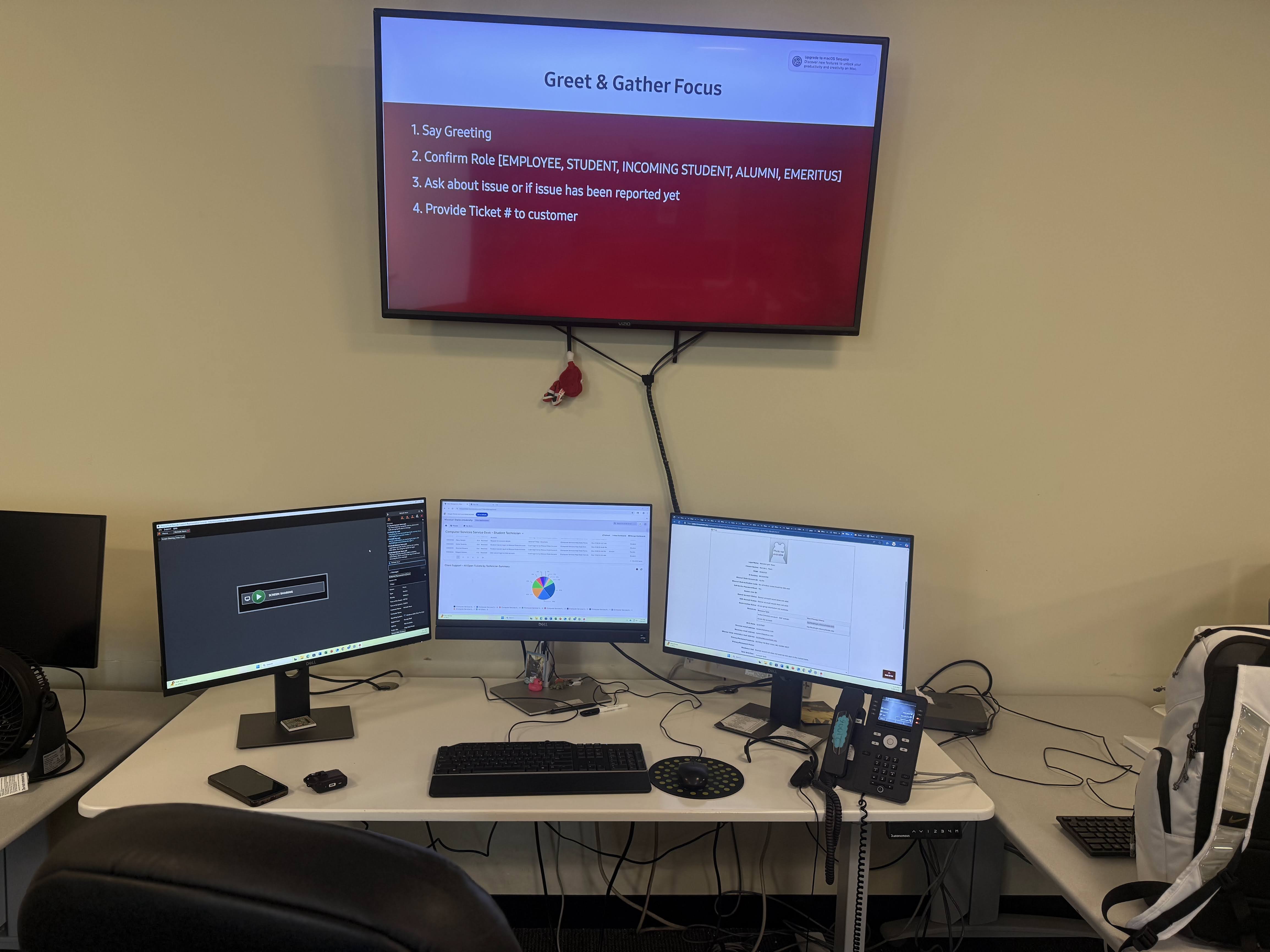
IT Technician | February 2025 – August 2025
- Ensured effective day-to-day operation and support for User Support's Open-Access Computer Labs and Call Center.
- Identified and resolved customer issues with software, University systems, computers, mobile devices, peripherals, network connections, and printers via phone, live chat, and in-person.
- Tracked all support work done in the User Support work management system and documented full details of support interactions.
- Provided technical support by assisting faculty and students in troubleshooting hardware/software issues, ensuring seamless IT operations.
- Created technical documentation as required.
- Deployed and configured computers with necessary software applications and security updates for classroom and administrative use.
- Handled incoming phone calls and live chats to troubleshoot technical issues and resolve support tickets efficiently as part of the IT support team.
- Maintained confidentiality while handling sensitive university IT data.
- Assisted users in navigating business platforms, providing guidance and first-line support aligned.
Amaravathi Software Innovations Pvt. Ltd
Systems Engineer | July 2022 – May 2024
- Developed RAML-based APIs using Mulesoft’s Anypoint Platform and built Mule flows to integrate data from various sources. Actively handled client communications and addressed technical queries.
- Collaborated on special IT projects, contributing to system updates, hardware installations, and process improvements.
- Prepared and presented weekly progress reports to stakeholders using PowerPoint.
- Documented all support interactions and resolutions within the IT work management system to ensure transparency and accountability.
Tata Consultancy Services
Assistant Systems Engineer | November 2020 to May 2022
- Worked with Active Directory Domain Services and Mulesoft.
- Provided excellent customer service by resolving over 120 requests daily, including incidents such as access provisioning, password resets, and server patching.
- Communicated effectively with 14 stakeholders by creating and presenting weekly PowerPoint updates.
- Documented all critical activities and tasks on a regular basis.
Education
-

-
Masters in Computer Science
-

-
Bachelors in Computer Science
-
Data Science Certificate
-
Graduate Certifications
-
Geo-Spatial Sciences Certificate
Missouri State University – Springfield, MO
Masters in Natural & Applied Sciences (Computer Science & Geo-Spatial Sciences) | August 2024 – May 2026
- GPA: 3.54 / 4.00
Rajamahendri Institute of Engineering and Technology – Andhra Pradesh, India
Bachelors of Technology in Computer Science Engineering | Graduated – May 2019
- GPA: 3.35 / 4.00
Projects
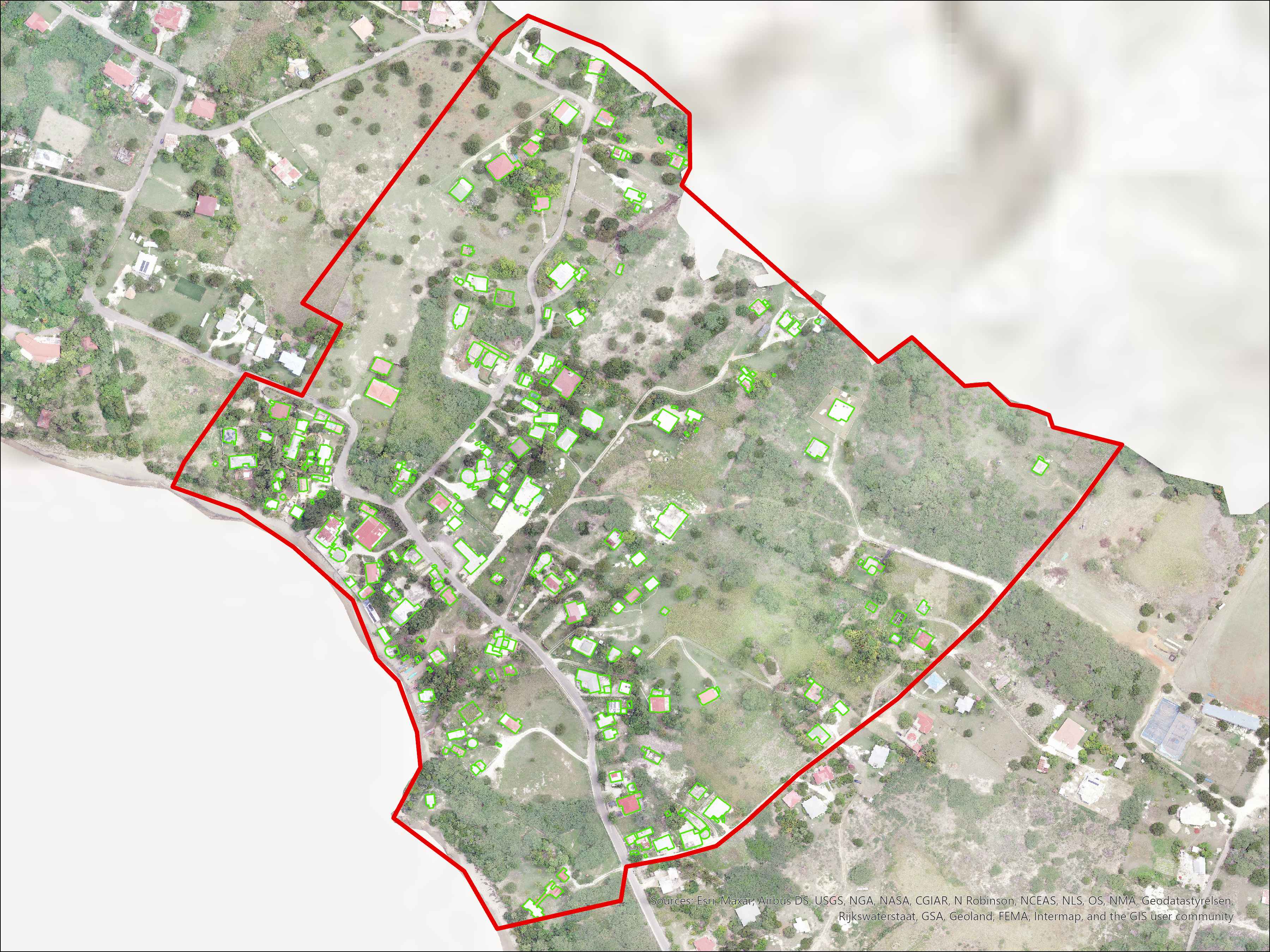
AI-Driven Automated Structure Mapping for Treasure Beach, Jamaica.
AI-powered deep learning model for identifying buildings in flood-prone zones using Drone imagery. Model detected over 85% of the structures through supervised learning.
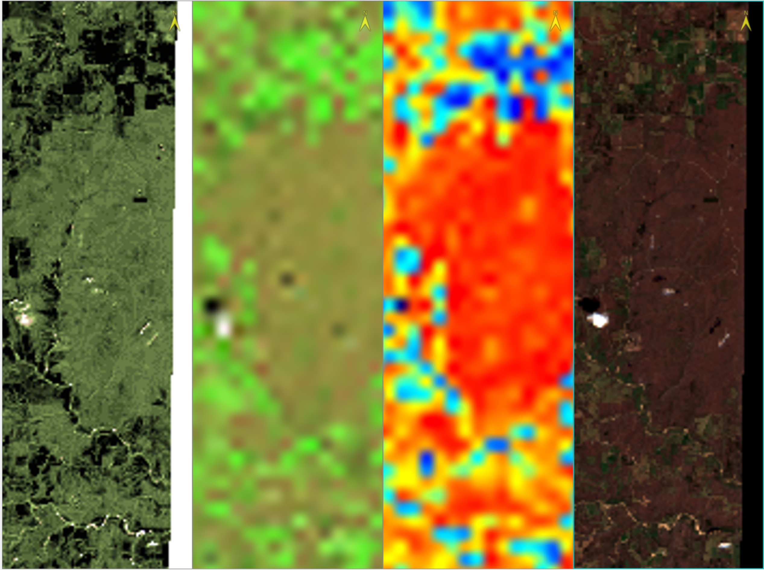
Scene Classification - Remote Sensing
Scene Classification of Satellite imagery obtained through Sentinel, through Supervised learning using Support Vector Machine algorithm and Confusion matrix calculation.
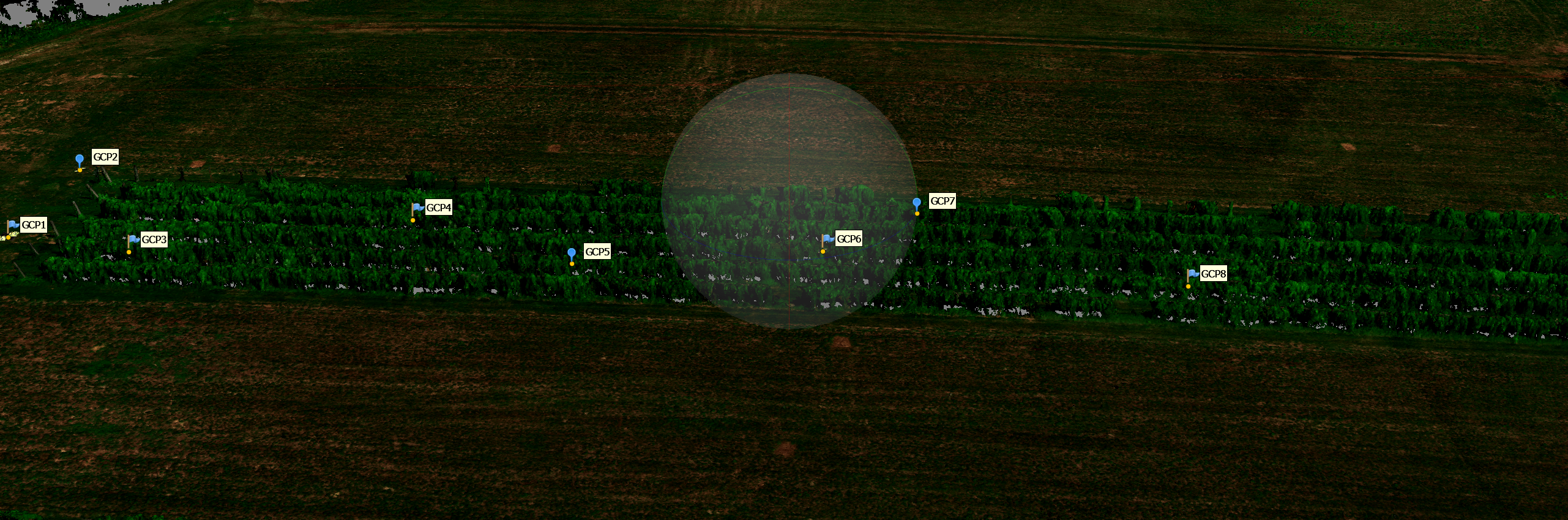
UAV-based Multispectral and LiDAR Data Acquisition and Geospatial Analysis at the Mountain Grove Vineyard
This project focused on applying UAV-based multispectral imaging and LiDAR technologies to vineyard research at the Fruit Experiment Station, Mountain Grove, Missouri.
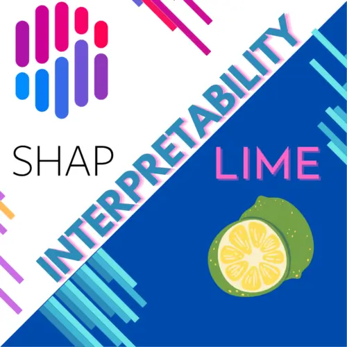
Explainable AI - LIME & SHAP Experiments
Jupyter notebooks demonstrating Explainable AI (XAI) techniques such as LIME and SHAP across different datasets and models

Tic-Tac-Toe
Python console game with an AI opponent and logic to detect draws or win conditions on a full board.
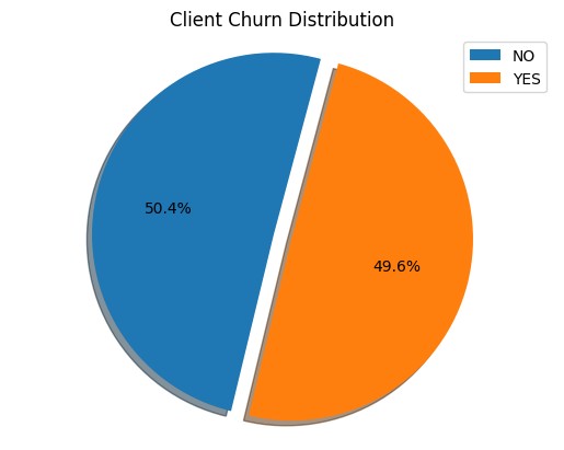
Customer Churn Prediction in Telecom - Data Analytics
This project applied binary classification using the Random Forest algorithm to predict customer churn in the telecom industry. A dataset containing 100,000 customer records with 100 features, including demographics, service usage, and billing details, was used.
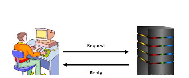
Socket Client-Server Loan Calculator
TCP/UDP-based client-server app that calculates loan payments in real-time with clean input validation.
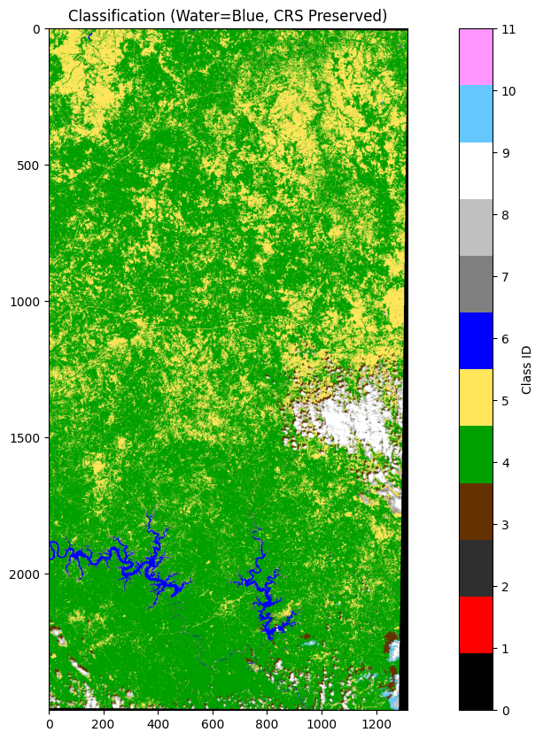
Scene Classification file conversion Using Python for Remote Sesnsing
This script converts a Sentinel-2 Scene Classification (SCL) RGB TIFF into an ENVI classification file while preserving all geospatial information.
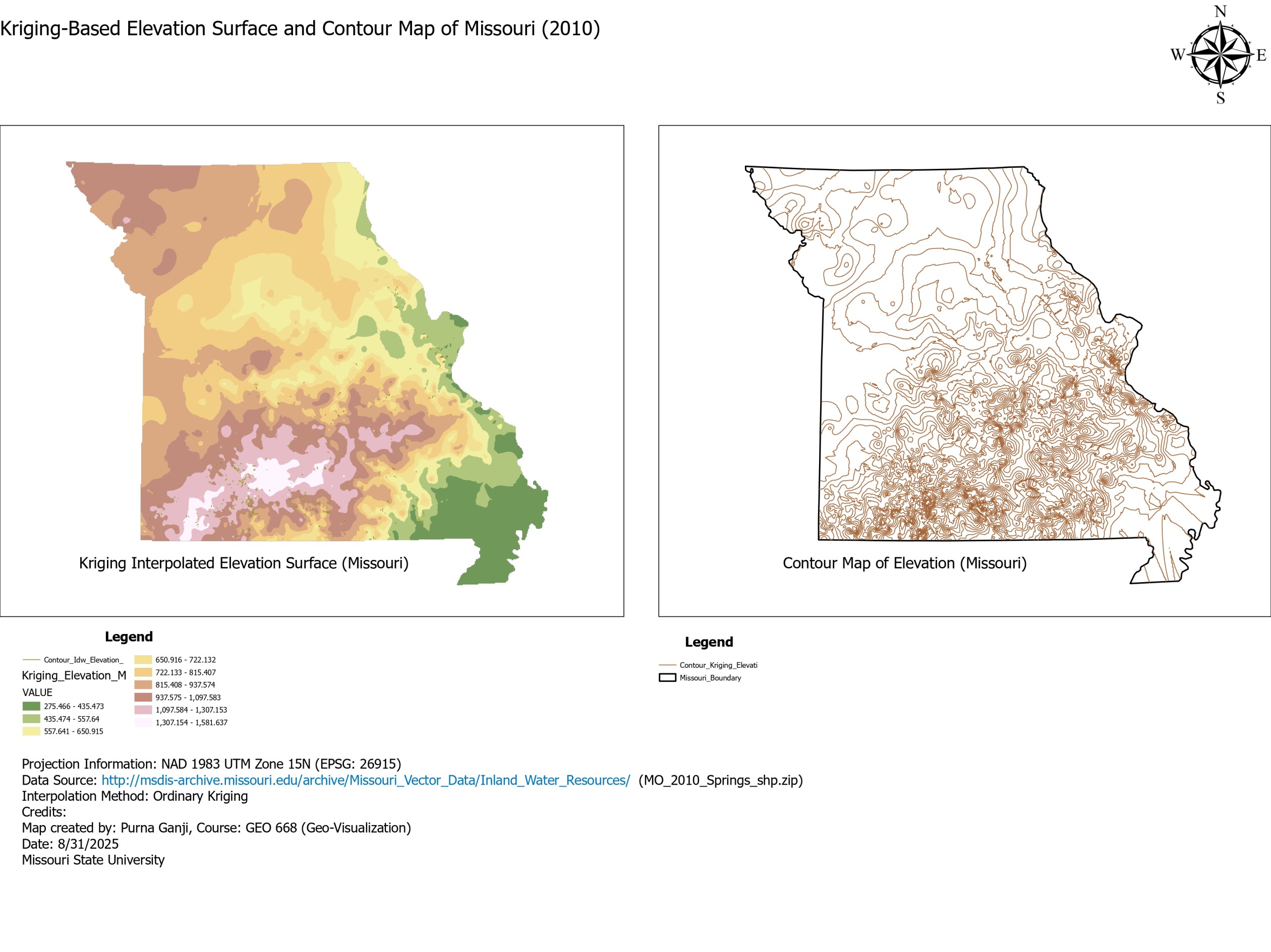
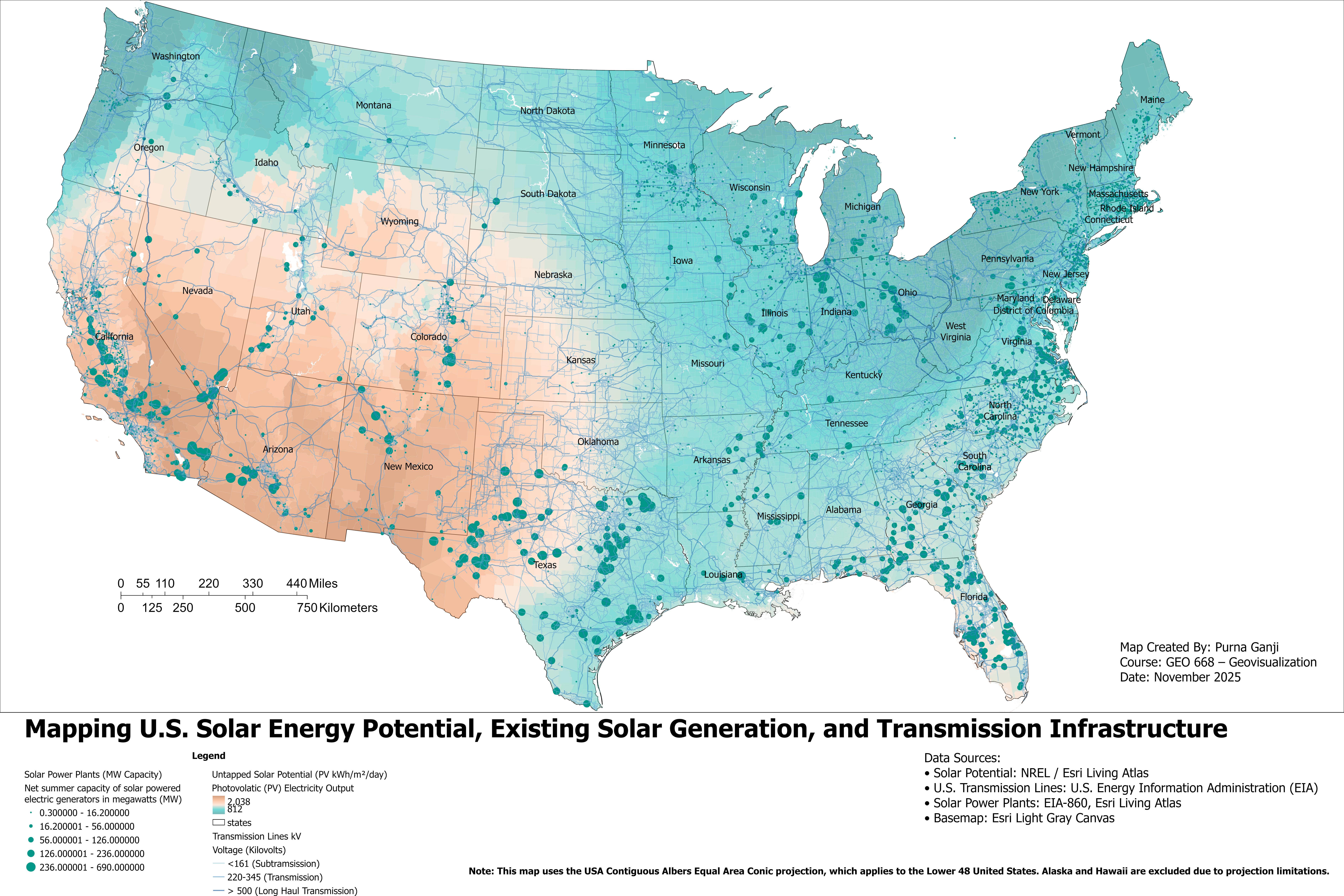
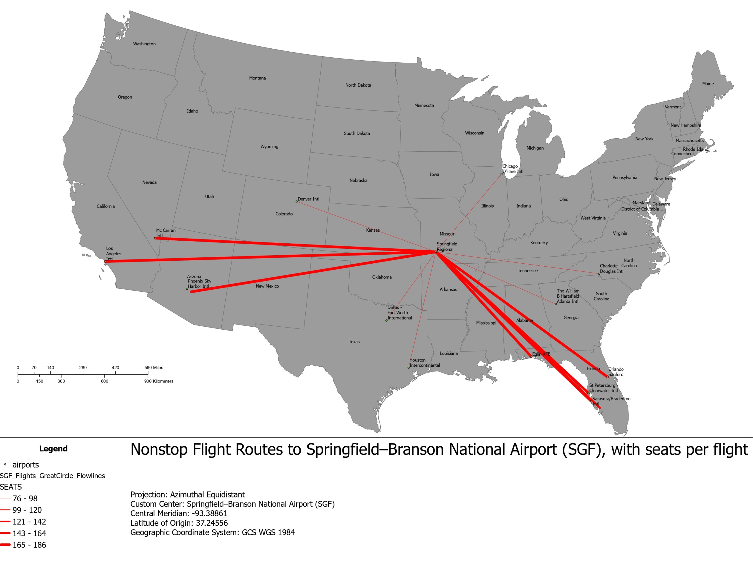
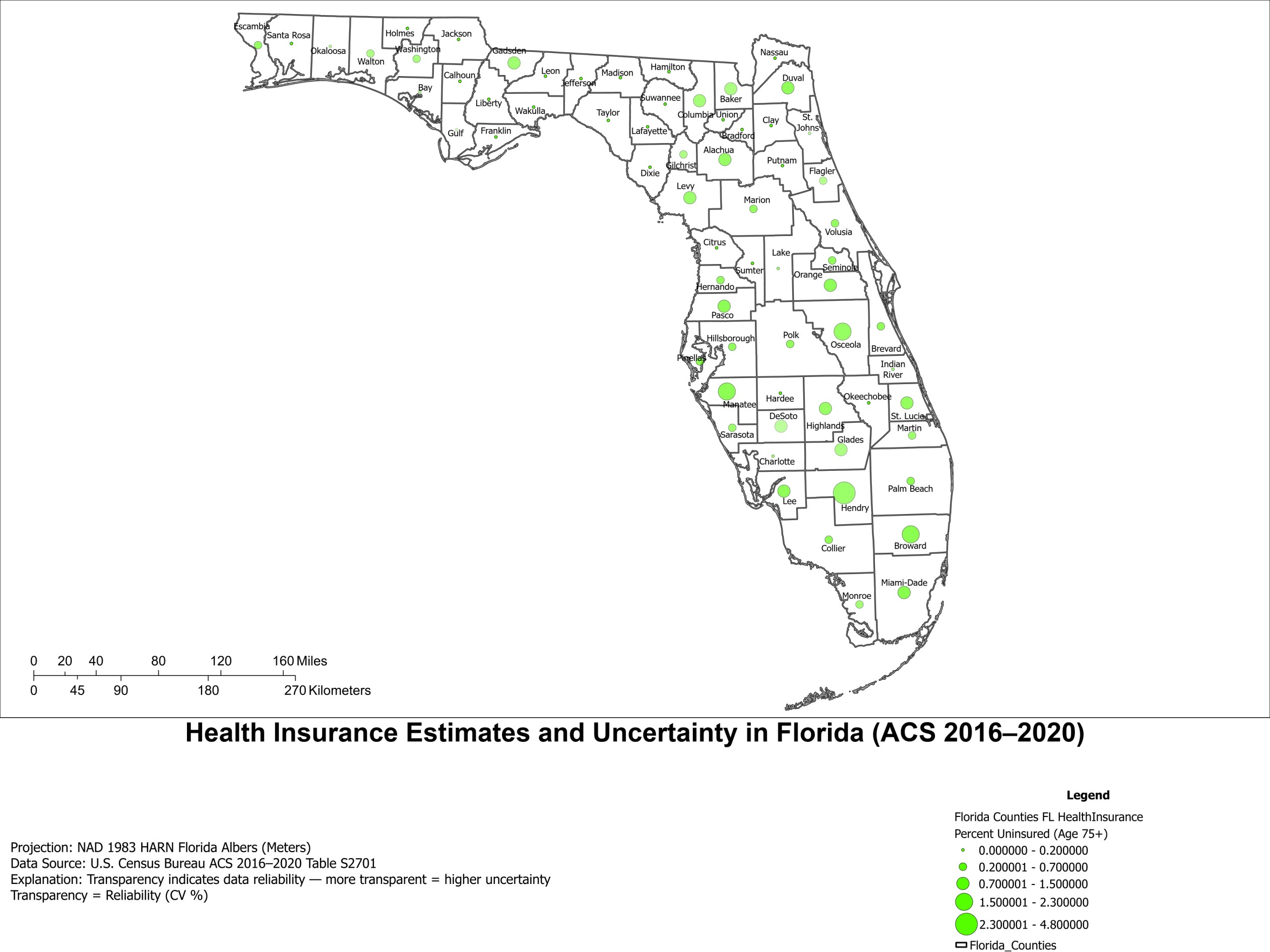
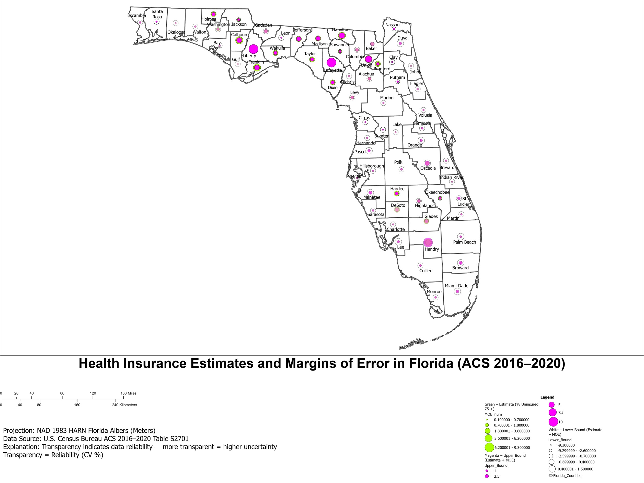
GIS Landscape Analysis Projects
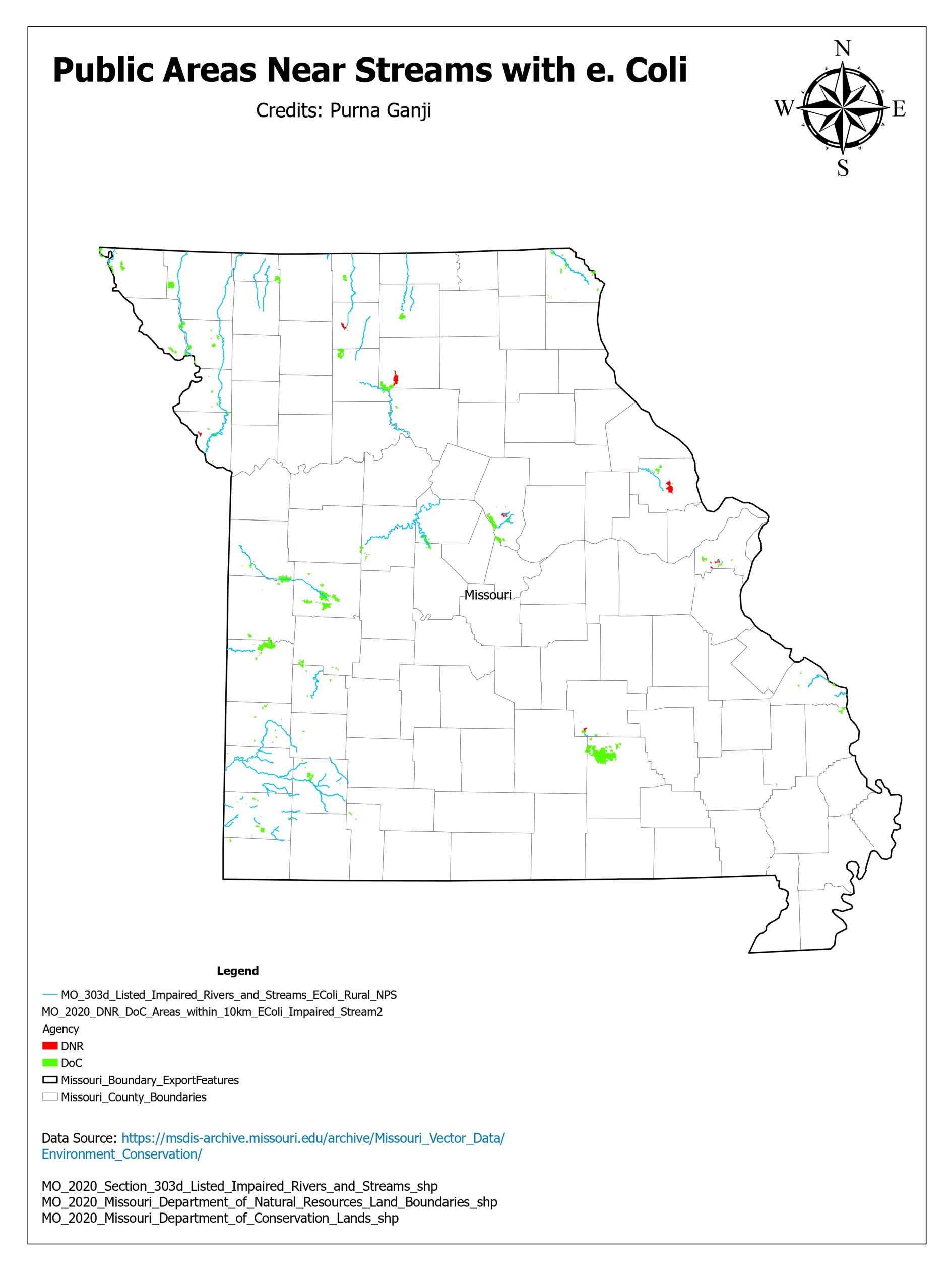
Assessment of Public Conservation Lands Vulnerable to E. Coli-Impaired Streams in Missouri

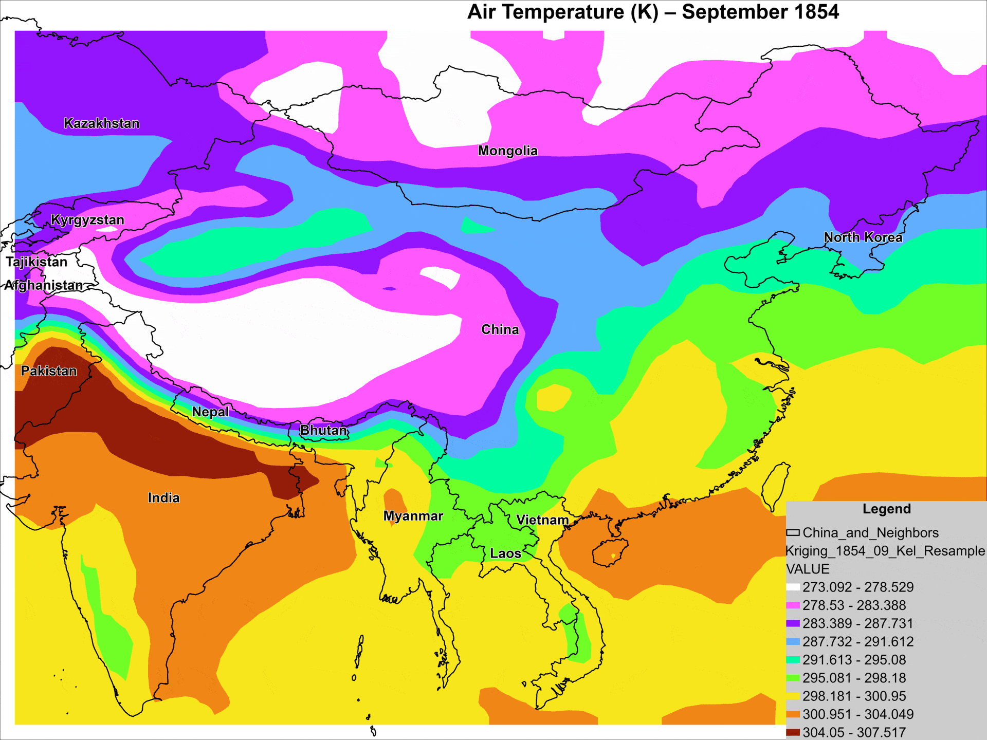
Precipitation Interpolation and Watershed-Based Rainfall Normalization — Minnesota, August 2007
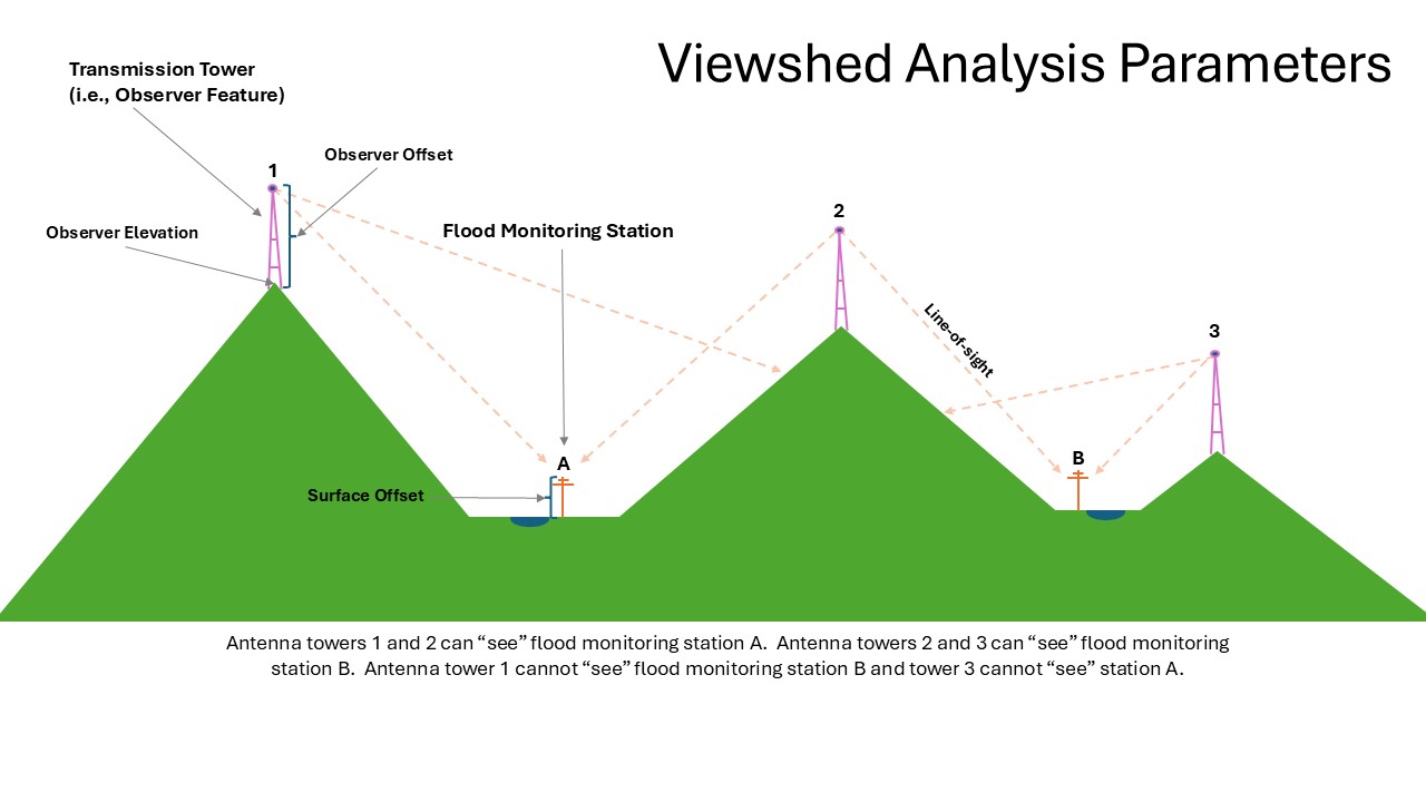
Line-of-Sight Viewshed Analysis for Wireless Coverage & Monitoring - Minnesota state,Winona County
.jpg)
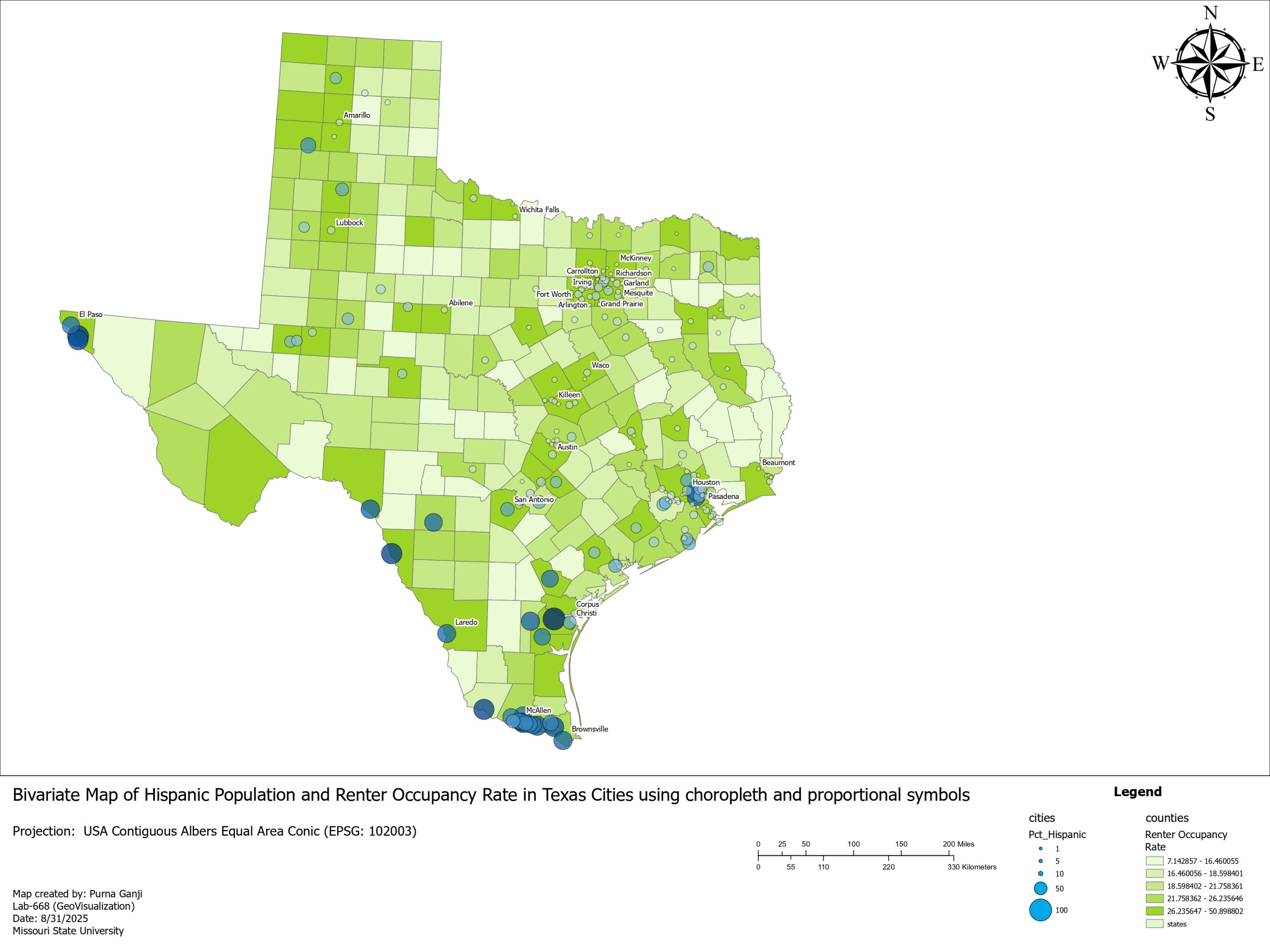
Bivariate Choropleth Map of Hispanic Population and Number of Farms (U.S. Counties, 1997)

.jpg)

Technical Stack
Languages
Operating Systems
Database
Softwares Used
System & Tools
Frameworks/Libraries
Google Workspace
Microsoft Office Suite
AI Used
Relevant Coursework
Development Expertise
Communication-Languages
GIS Analytical Skills
GIS Field Skills
Soft Skills
References

Dr. Toby Dogwiler
Jamie N. Lee

Captain Dave Harp

Matthew L. Stroup

Daisy Mullen
S.T.P. Goda Vyshnavi
J.Balakaruppiah
Contact
Let’s build something impactful. Reach out to discuss opportunities or collaborations.
- Email: pg84s@missouristate.edu
- LinkedIn: LinkedIn Profile
- GitHub: GitHub Profile
- Phone: +1 417-353-5870
Social Media
Click to see my profile or contact me in different platforms.